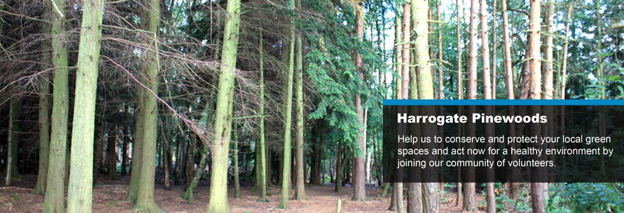
The Pinewoods is approximately 96 acres of semi-natural woodland, one kilometre south west of Harrogate town centre. A full plan of the site is available here. There is also a Pinewoods Management Plan to guide both the Council and Conservation Group with all future plans for the site.
Access
Access to the woodland is available via tarmac footpaths from the town centre of Harrogate and road links using public transport from Knaresborough. Parking for cars is available off Crag Lane close to the wood at its most south-westerly point. However, access by local residents is generally made on foot. Although the Pinewoods is situated at the highest point in Harrogate, many of the paths through it are relatively flat. One of the most popular walks is that which links the Valley Gardens with the Royal Horticultural Society's Harlow Carr gardens on Crag Lane, which is locally referred to as either mile or memorial walk.
Footpaths
The site contains numerous footpaths, which are easily accessible from Crag Lane, Harlow Moor Road, Harlow Moor Drive and through Valley Gardens, which adjoins Pinewoods at its north-easterly point. Mile Walk runs from the access point off Crag lane through to the War Memorial where Pinewoods meets Valley Gardens (or vice versa). bitumen footpath allows for pedestrian and wheelchair access along its entire length, thus allowing everybody to enjoy the benefits of the woodland.
Walks
A number of walks are available through and around The Pinewoods. The "Walking Englishman" has published an easy 1.5m walk that should take around 1 hour that takes in the best of what The Pinewoods has to offer. More details and a map can be found here. For something a bit more ambitious there is a 3.6m walk taking in Valley Gardens and Birk Crag that can be found here.
The RHS have also published a map from Harrogate, via The Pinewoods to RHS Harlow Carr. This can be downloaded here.
Orienteering
The are 3 orienteering routes that include the Pinewoods. These are:
- Novice (1.4km): Novice is on paths in easy parkland or woods on fairly flat terrain.
- Intermediate (3.9km): Intermediate is partly on the Novice area and partly in denser woods.
- Long (7.7Km). Long covers all this, but extends into a rough, steep and more technical area.
These are managed by Claro Orienteering with full details of the routes being available here. Maps are available via Harrogate Tourist Information Centre and the “White Hut” by the Tennis courts in Valley Gardens.
Information Boards
The site currently has three information boards and one panorama information board, highlighting woodland footpaths, local flora and fauna, points of interest within the local landscape, upcoming events within the woodland and contact details for the Pinewoods Conservation Group.The information boards are located off Crag Lane, adjoining Mile Walk within the recreation area of the woodland and adjoining the War Memorial where Pinewoods meets Valley Gardens.
Site and Area
Pinewoods is a semi-natural woodland of approximately 1 square kilometre in size (76 acres) and located one kilometre south west of the town centre and on the western aspect of Harrogate, North Yorkshire. Map location coordinates are: 420648.00E, 454432.00N. The site provides informal recreational areas and sites of local and general conservational interest. As such, the woodland is managed by Harrogate Borough Council and local volunteer groups so as to try to balance the recreation and conservation aspects of the site itself.
The original Scots Pines (Pinus sylvestris), from where the Pinewoods takes its name, were planted in 1796 as part of the Kings Plantation and originally covered some 6 acres in area. The Pines are still in evidence today although it is unlikely that any of the originals exist. Thorpe's Guide (1891) describes the site as 'the rough moor where firs, gorse and heather abound in profusion forming a capital protection for the ground game and feathered tribe'. The land itself was purchased from the Earl of Harewood by the Corporation in 1898 and has since developed, both naturally and through the assistance of planting schemes, into a semi-natural woodland of mixed native, deciduous and evergreen species.
Woodland Series
The site is identified as a lowland mix classification and is within the criteria of the National Vegetation Classification (NVC) W 18 Pinus sylvestris Hylocomium splendens woodland (Rodwell, 1991). This classification was identified in 1991. However, based on current observations, the woodland may, in the longer-term, potentially show signs of transition to W10 (Quercus -pteridium-rubus).
Aspect and Topography
The site itself runs gently from north-east to south-west, with an overall fall of approximately 20 metres between the northern and southern boundary. The wood is characteristically wet at its lowest points during many of the winter months and contains a number ditch channels to help drain surface and sub-surface moisture.
Soils and Geology
Pinewoods is situated within an area of Carboniferous Millstone grits (Red Scar Grit) and Shale. Soils are poor to moderately drained and are comprised mainly of silt clay and small stone.
Climate
No specific data has been collected but the area may be expected to be typical of this part of the County of North Yorkshire.
Age Class
There is a good age class distribution throughout the woodland. There is a clear impact of a young under story of beech, pine, rowan, oak and birch with an age range of 3-15 years. The upper canopy layer predominantly exceeds 70 years in age.